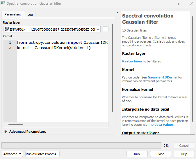
Spectral convolution Gaussian filter
1D Gaussian filter. The Gaussian filter is a filter with great smoothing properties. It is isotropic and does not produce artifacts.
This 1D Gaussian filter applies a weighted average to the values in the image. The weights are determined by a Gaussian distribution, which assigns higher weights to pixels closer to the center of the kernel and lower weights to pixels farther away. It is isotropic and does not produce artifacts.
Usage:
Start the algorithm from the Processing Toolbox panel.
Select the raster to process and modify the parameterization if necessary, then click run.
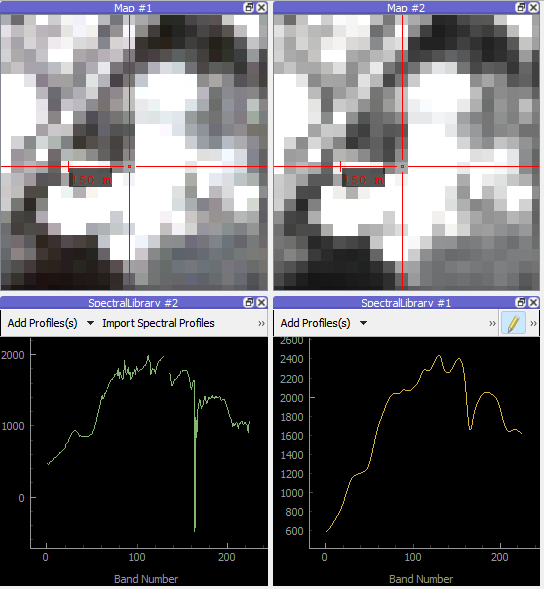
Processed image in comparison to the original.
Parameters
- Raster layer [raster]
Raster layer to be filtered.
- Kernel [string]
Python code. See Gaussian1DKernel for information on different parameters.
Default:
from astropy.convolution import Gaussian1DKernel
kernel = Gaussian1DKernel(stddev=1)
- Normalize kernel [boolean]
Whether to normalize the kernel to have a sum of one.
Default: False
- Interpolate no data pixel [boolean]
Whether to interpolate no data pixel. Will result in renormalization of the kernel at each position ignoring pixels with no data values.
Default: True
Outputs
- Output raster layer [rasterDestination]
Raster file destination.
Command-line usage
>qgis_process help enmapbox:SpectralConvolutionGaussianFilter:
----------------
Arguments
----------------

raster: Raster layer
    Argument type:  raster
    Acceptable values:
            - Path to a raster layer
kernel: Kernel
    Default value:  from astropy.convolution import Gaussian1DKernel
kernel = Gaussian1DKernel(stddev=1)
    Argument type:  string
    Acceptable values:
            - String value
            - field:FIELD_NAME to use a data defined value taken from the FIELD_NAME field
            - expression:SOME EXPRESSION to use a data defined value calculated using a custom QGIS expression
normalize: Normalize kernel
    Default value:  false
    Argument type:  boolean
    Acceptable values:
            - 1 for true/yes
            - 0 for false/no
            - field:FIELD_NAME to use a data defined value taken from the FIELD_NAME field
            - expression:SOME EXPRESSION to use a data defined value calculated using a custom QGIS expression
interpolate: Interpolate no data pixel
    Default value:  true
    Argument type:  boolean
    Acceptable values:
            - 1 for true/yes
            - 0 for false/no
            - field:FIELD_NAME to use a data defined value taken from the FIELD_NAME field
            - expression:SOME EXPRESSION to use a data defined value calculated using a custom QGIS expression
outputRaster: Output raster layer
    Argument type:  rasterDestination
    Acceptable values:
            - Path for new raster layer

----------------
Outputs
----------------

outputRaster: <outputRaster>
    Output raster layer