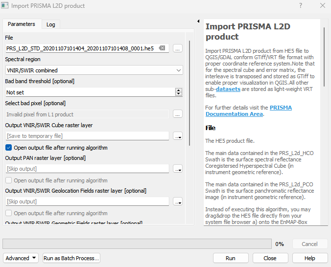
Import PRISMA L2D product
Import PRISMA L2D product from HE5 file to QGIS/GDAL conform GTiff/VRT file format with proper coordinate reference system.Note that for the spectral cube and error matrix, the interleave is transposed and stored as GTiff to enable proper visualization in QGIS.All other sub-datasets are stored as light-weight VRT files. For further details visit the PRISMA Documentation Area.
Usage:
Open the algorithm from the processing toolbox.
Select the metadata file, then click run.
The output raster can be found under Rasters in the Data Source Panel
Parameters
- File [file]
The HE5 product file. The main data contained in the PRS_L2d_HCO Swath is the surface spectral reflectance Coregistersed Hyperspectral Cube (in instrument geometric reference). The main data contained in the PRS_L2d_PCO Swath is the surface panchromatic reflectance image (in instrument geometric reference). Instead of executing this algorithm, you may drag&drop the HE5 file directly from your system file browser a) onto the EnMAP-Box map view area, or b) onto the Sensor Product Import panel.
- Spectral region [enum]
Spectral region to be imported.
Default: 0
- Bad band threshold [number]
If the proportion of erroneous pixels in the VNIR/SWIR Pixel Error Matrix,exceeds the bad band threshold (a value between 0 and 1), the band is marked as a bad band. If specified, Output VNIR/SWIR Error Matrix raster layer needs to be specified as well.
- Select bad pixel [enum]
Pixels concidered to be erroneous.
Default: [0]
Outputs
- Output VNIR/SWIR Cube raster layer [rasterDestination]
VNIR/SWIR Cube GTiff raster file destination. The surface spectral reflectance Coregistersed Hyperspectral Cube (in instrument geometric reference).
- Output PAN raster layer [rasterDestination]
PAN VRT raster file destination. The surface panchromatic reflectance image (in instrument geometric reference).
- Output VNIR/SWIR Geolocation Fields raster layer [rasterDestination]
VNIR/SWIR Geolocation Fields VRT raster file destination. Includes Latitude and Longitude bands.
- Output VNIR/SWIR Geometric Fields raster layer [rasterDestination]
VNIR/SWIR Geometric Fields VRT raster file destination. Includes Observing Angle, Relative Azimuth Angle and Solar Zenith Angle bands.
- Output VNIR/SWIR Error Matrix raster layer [rasterDestination]
VNIR/SWIR Pixel Error Matrix GTiff raster file destination.
- Output PAN Geolocation Fields raster layer [rasterDestination]
PAN Geolocation Fields VRT raster file destination. Includes Latitude and Longitude bands.
- Output PAN Error Matrix raster layer [rasterDestination]
PAN Pixel Error Matrix VRT raster file destination.
Command-line usage
>qgis_process help enmapbox:ImportPrismaL2DProduct:
----------------
Arguments
----------------

file: File
    Argument type:  file
    Acceptable values:
            - Path to a file
spectralRegion: Spectral region
    Default value:  0
    Argument type:  enum
    Available values:
            - 0: VNIR/SWIR combined
            - 1: VNIR only
            - 2: SWIR only
    Acceptable values:
            - Number of selected option, e.g. '1'
            - Comma separated list of options, e.g. '1,3'
badBandThreshold: Bad band threshold (optional)
    Argument type:  number
    Acceptable values:
            - A numeric value
            - field:FIELD_NAME to use a data defined value taken from the FIELD_NAME field
            - expression:SOME EXPRESSION to use a data defined value calculated using a custom QGIS expression
badPixelType: Select bad pixel (optional)
    Default value:
    Argument type:  enum
    Available values:
            - 0: Invalid pixel from L1 product
            - 1: Negative value after atmospheric correction
            - 2: Saturated value after atmospheric correction
    Acceptable values:
            - Number of selected option, e.g. '1'
            - Comma separated list of options, e.g. '1,3'
outputPrismaL2D_spectralCube: Output VNIR/SWIR Cube raster layer
    Argument type:  rasterDestination
    Acceptable values:
            - Path for new raster layer
outputPrismaL2D_panCube: Output PAN raster layer (optional)
    Argument type:  rasterDestination
    Acceptable values:
            - Path for new raster layer
outputPrismaL2D_spectralGeolocationFields: Output VNIR/SWIR Geolocation Fields raster layer (optional)
    Argument type:  rasterDestination
    Acceptable values:
            - Path for new raster layer
outputPrismaL2D_spectralGeometricFields: Output VNIR/SWIR Geometric Fields raster layer (optional)
    Argument type:  rasterDestination
    Acceptable values:
            - Path for new raster layer
outputPrismaL2D_spectralErrorMatrix: Output VNIR/SWIR Error Matrix raster layer (optional)
    Argument type:  rasterDestination
    Acceptable values:
            - Path for new raster layer
outputPrismaL2D_panGeolocationFields: Output PAN Geolocation Fields raster layer (optional)
    Argument type:  rasterDestination
    Acceptable values:
            - Path for new raster layer
outputPrismaL2D_panErrorMatrix: Output PAN Error Matrix raster layer (optional)
    Argument type:  rasterDestination
    Acceptable values:
            - Path for new raster layer

----------------
Outputs
----------------

outputPrismaL2D_spectralCube: <outputRaster>
    Output VNIR/SWIR Cube raster layer
outputPrismaL2D_panCube: <outputRaster>
    Output PAN raster layer
outputPrismaL2D_spectralGeolocationFields: <outputRaster>
    Output VNIR/SWIR Geolocation Fields raster layer
outputPrismaL2D_spectralGeometricFields: <outputRaster>
    Output VNIR/SWIR Geometric Fields raster layer
outputPrismaL2D_spectralErrorMatrix: <outputRaster>
    Output VNIR/SWIR Error Matrix raster layer
outputPrismaL2D_panGeolocationFields: <outputRaster>
    Output PAN Geolocation Fields raster layer
outputPrismaL2D_panErrorMatrix: <outputRaster>
    Output PAN Error Matrix raster layer