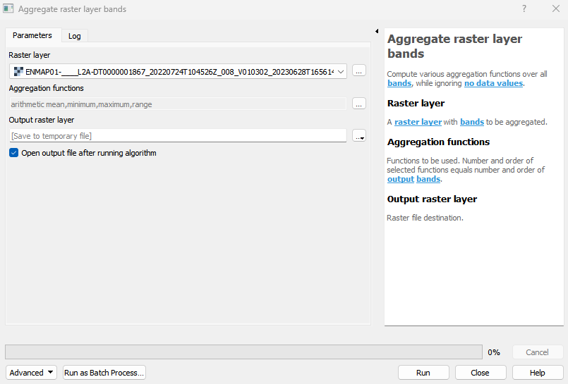
Aggregate raster layer bands
Compute various aggregation functions over all bands, while ignoring no data values.
Usage:
Open the algorithm from the processing toolbox.
Select a raster layer and your desired aggregation functions, then click run.
The output raster can be found under Rasters in the Data Source Panel
Parameters
- Raster layer [raster]
A raster layer with bands to be aggregated.
- Aggregation functions [enum]
Functions to be used. Number and order of selected functions equals number and order of output bands.
Outputs
- Output raster layer [rasterDestination]
Raster file destination.
Command-line usage
>qgis_process help enmapbox:AggregateRasterLayerBands:
----------------
Arguments
----------------

raster: Raster layer
    Argument type:  raster
    Acceptable values:
            - Path to a raster layer
function: Aggregation functions
    Argument type:  enum
    Available values:
            - 0: arithmetic mean
            - 1: standard deviation
            - 2: variance
            - 3: minimum
            - 4: median
            - 5: maximum
            - 6: sum
            - 7: product
            - 8: range
            - 9: interquartile range
            - 10: any true
            - 11: all true
            - 12: arg minimum
            - 13: arg maximum
            - 14: 0-th percentile
            - 15: 1-th percentile
            - 16: 2-th percentile
            - 17: 3-th percentile
            - 18: 4-th percentile
            - 19: 5-th percentile
            - 20: 6-th percentile
            - 21: 7-th percentile
            - 22: 8-th percentile
            - 23: 9-th percentile
            - 24: 10-th percentile
            - 25: 11-th percentile
            - 26: 12-th percentile
            - 27: 13-th percentile
            - 28: 14-th percentile
            - 29: 15-th percentile
            - 30: 16-th percentile
            - 31: 17-th percentile
            - 32: 18-th percentile
            - 33: 19-th percentile
            - 34: 20-th percentile
            - 35: 21-th percentile
            - 36: 22-th percentile
            - 37: 23-th percentile
            - 38: 24-th percentile
            - 39: 25-th percentile
            - 40: 26-th percentile
            - 41: 27-th percentile
            - 42: 28-th percentile
            - 43: 29-th percentile
            - 44: 30-th percentile
            - 45: 31-th percentile
            - 46: 32-th percentile
            - 47: 33-th percentile
            - 48: 34-th percentile
            - 49: 35-th percentile
            - 50: 36-th percentile
            - 51: 37-th percentile
            - 52: 38-th percentile
            - 53: 39-th percentile
            - 54: 40-th percentile
            - 55: 41-th percentile
            - 56: 42-th percentile
            - 57: 43-th percentile
            - 58: 44-th percentile
            - 59: 45-th percentile
            - 60: 46-th percentile
            - 61: 47-th percentile
            - 62: 48-th percentile
            - 63: 49-th percentile
            - 64: 50-th percentile
            - 65: 51-th percentile
            - 66: 52-th percentile
            - 67: 53-th percentile
            - 68: 54-th percentile
            - 69: 55-th percentile
            - 70: 56-th percentile
            - 71: 57-th percentile
            - 72: 58-th percentile
            - 73: 59-th percentile
            - 74: 60-th percentile
            - 75: 61-th percentile
            - 76: 62-th percentile
            - 77: 63-th percentile
            - 78: 64-th percentile
            - 79: 65-th percentile
            - 80: 66-th percentile
            - 81: 67-th percentile
            - 82: 68-th percentile
            - 83: 69-th percentile
            - 84: 70-th percentile
            - 85: 71-th percentile
            - 86: 72-th percentile
            - 87: 73-th percentile
            - 88: 74-th percentile
            - 89: 75-th percentile
            - 90: 76-th percentile
            - 91: 77-th percentile
            - 92: 78-th percentile
            - 93: 79-th percentile
            - 94: 80-th percentile
            - 95: 81-th percentile
            - 96: 82-th percentile
            - 97: 83-th percentile
            - 98: 84-th percentile
            - 99: 85-th percentile
            - 100: 86-th percentile
            - 101: 87-th percentile
            - 102: 88-th percentile
            - 103: 89-th percentile
            - 104: 90-th percentile
            - 105: 91-th percentile
            - 106: 92-th percentile
            - 107: 93-th percentile
            - 108: 94-th percentile
            - 109: 95-th percentile
            - 110: 96-th percentile
            - 111: 97-th percentile
            - 112: 98-th percentile
            - 113: 99-th percentile
            - 114: 100-th percentile
    Acceptable values:
            - Number of selected option, e.g. '1'
            - Comma separated list of options, e.g. '1,3'
outputRaster: Output raster layer
    Argument type:  rasterDestination
    Acceptable values:
            - Path for new raster layer

----------------
Outputs
----------------

outputRaster: <outputRaster>
    Output raster layer