EnMAP-Box 3 Documentation
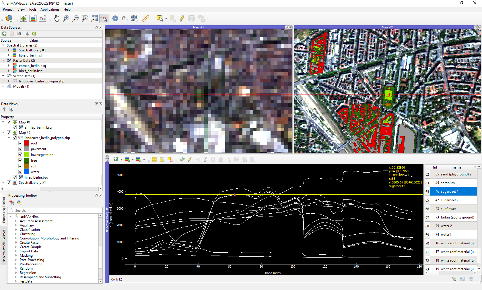
The EnMAP-Box is a python plugin for QGIS, designed to process and visualise hyperspectral remote sensing data.
Get going with the Installation and the Getting Started chapter. Have a look at the Cookbook for usage examples!
Key features
- Extend your QGIS for remote sensing image analysis
- Add powerful tools to process and analyse imaging spectroscopy data
- Integrate machine learning algorithms into your image classification and regression with Random Forests, Support Vector Machines and many more
- Create and manage spectral libraries with attribute data
- Develop your own image processing algorithms using a powerful Python API
News
EnMAP-Box Version 3.10 released
June 09, 2022
A new EnMAP-Box version has been released. A list of all improvements can be found in the changelog.
EnMAP-Box Version 3.9 released
Oct. 10, 2021
A new EnMAP-Box version has been released. A list of all improvements can be found in the changelog.
EnMAP-Box Workshop 2021
Jun, 07, 2021
The next EnMAP-Box workshop will be held online on 21-23 June, 2021. The workshop aims to demonstrate the current state of the EnMAP-Box by way of presentations, live demos with Q&A and self-paced tutorials. Registration for up to 250 participants is now open at the workshop website.
FOSSGIS 2021
Jun 09, 2021
Benjamin Jakimow presented how to use Spectral Libraries in QGIS using the EnMAP-Box (german).
EnMAP-Box Version 3.7 released
Oct. 27, 2020
A new EnMAP-Box version has been released. It includes product readers for EnMAP L1B, L2C and L2A, PRISMA L2D and DESIS L2A images, and a first version of Spectral Math in the QGIS Expression Builder. A list of all improvements can be found in the changelog.
FOSSGIS 2020
Andreas Rabe presented the EnMAP-Box at the FOSSGIS 2020 in Freiburg. See the full live-demo session here (german):
QGIS User Conference 2019
Two Presentations by EnMAP-Box developers Andreas Rabe and Benjamin Jakimow at the QGIS User conference in Coruña
- Earth observation data processing in QGIS with a python API
- EO Time Series Viewer - A plugin to explore Earth Observation Time Series Data in QGIS