Translate raster layer
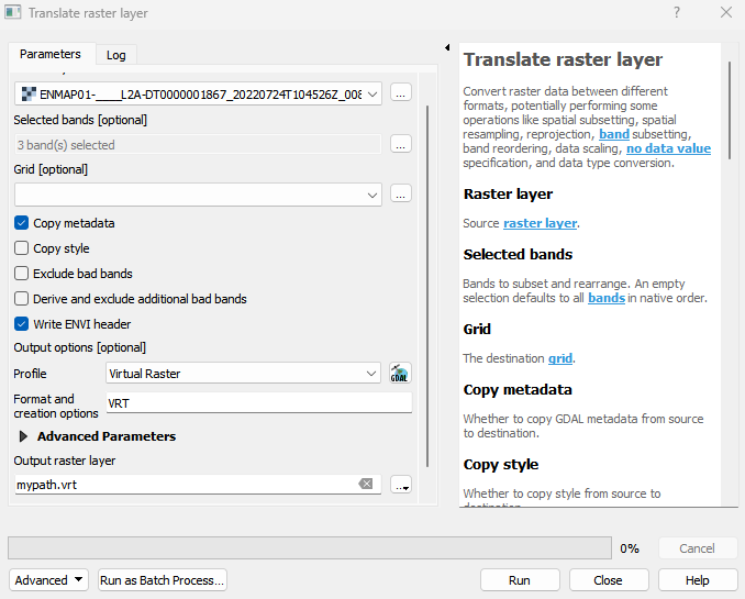
Convert raster data between different formats, potentially performing some operations like spatial subsetting, spatial resampling, reprojection, band subsetting, band reordering, data scaling, no data value specification, and data type conversion.
Usage:
Open the algorithm from the processing toolbox.
Select a raster layer and specify data format and filepath. Under Advanced Parameters you find powerful additional features like options for band or spatial subsetting . Then click run.
Parameters
- Raster layer [raster]
Source raster layer.
- Selected bands [band]
Bands to subset and rearrange. An empty selection defaults to all bands in native order.
- Grid [raster]
The destination grid.
- Copy metadata [boolean]
Whether to copy GDAL metadata from source to destination. Default: True
- Copy style [boolean]
Whether to copy style from source to destination. Default: False
- Exclude bad bands [boolean]
Whether to exclude bad bands (given by BBL metadata item inside ENVI domain). Also see The ENVI Header Format for more details: https://www.nv5geospatialsoftware.com/docs/enviheaderfiles.html Default: False
- Derive and exclude additional bad bands [boolean]
Whether to derive and exclude additional bad bands fully filled with inf, nan or no data values. Default: False
- Write ENVI header [boolean]
Whether to write an ENVI header *.hdr sidecar file with spectral metadata required for proper visualization in ENVI software. Default: True
- Spectral raster layer for band subsetting [raster]
A spectral raster layer used for specifying a band subset by matching the center wavelength.
- Selected spectral bands [band]
Spectral bands used to match source raster bands.An empty selection defaults to all bands in native order.
- Data offset value [number]
A data offset value applied to each band.
- Data scale value [number]
A data scale value applied to each band.
- Spatial extent [extent]
Spatial extent for clipping the destination grid, which is given by the source Raster or the selected Grid. In both cases, the extent is aligned with the actual pixel grid to avoid subpixel shifts.
- Column subset [range]
Column subset range in pixels to extract.
- Row subset [range]
Rows subset range in pixels to extract.
- Resample algorithm [enum]
Spatial resample algorithm. Default: 0
- Source no data value [number]
The value to be used instead of the original raster layer no data value.
- No data value [number]
The value to be used instead of the default destination no data value.
- Unset source no data value [boolean]
Whether to unset (i.e. not use) the source no data value. Default: False
- Unset no data value [boolean]
Whether to unset the destination no data value. Default: False
- Working Data type [enum]
Working data type that is applied before resampling.
- Data type [enum]
Output data type.
- Output options [string]
Output format and creation options. The default format is GeoTiff with creation options: INTERLEAVE=BAND, COMPRESS=LZW, TILED=YES, BIGTIFF=YES Default: **
Outputs
- Output raster layer [rasterDestination]
Raster file destination.
Command-line usage
>qgis_process help enmapbox:translaterasterlayer:
----------------
Arguments
----------------

raster: Raster layer
    Argument type:    raster
    Acceptable values:
        - Path to a raster layer
bandList: Selected bands (optional)
    Argument type:    band
    Acceptable values:
        - Integer value representing an existing raster band number
grid: Grid (optional)
    Argument type:    raster
    Acceptable values:
        - Path to a raster layer
copyMetadata: Copy metadata
    Default value:    true
    Argument type:    boolean
    Acceptable values:
        - 1 for true/yes
        - 0 for false/no
        - field:FIELD_NAME to use a data defined value taken from the FIELD_NAME field
        - expression:SOME EXPRESSION to use a data defined value calculated using a custom QGIS expression
copyStyle: Copy style
    Default value:    false
    Argument type:    boolean
    Acceptable values:
        - 1 for true/yes
        - 0 for false/no
        - field:FIELD_NAME to use a data defined value taken from the FIELD_NAME field
        - expression:SOME EXPRESSION to use a data defined value calculated using a custom QGIS expression
excludeBadBands: Exclude bad bands
    Default value:    false
    Argument type:    boolean
    Acceptable values:
        - 1 for true/yes
        - 0 for false/no
        - field:FIELD_NAME to use a data defined value taken from the FIELD_NAME field
        - expression:SOME EXPRESSION to use a data defined value calculated using a custom QGIS expression
excludeDerivedBadBands: Derive and exclude additional bad bands
    Default value:    false
    Argument type:    boolean
    Acceptable values:
        - 1 for true/yes
        - 0 for false/no
        - field:FIELD_NAME to use a data defined value taken from the FIELD_NAME field
        - expression:SOME EXPRESSION to use a data defined value calculated using a custom QGIS expression
writeEnviHeader: Write ENVI header
    Default value:    true
    Argument type:    boolean
    Acceptable values:
        - 1 for true/yes
        - 0 for false/no
        - field:FIELD_NAME to use a data defined value taken from the FIELD_NAME field
        - expression:SOME EXPRESSION to use a data defined value calculated using a custom QGIS expression
spectralSubset: Spectral raster layer for band subsetting (optional)
    Argument type:    raster
    Acceptable values:
        - Path to a raster layer
spectralBandList: Selected spectral bands (optional)
    Argument type:    band
    Acceptable values:
        - Integer value representing an existing raster band number
offset: Data offset value (optional)
    Argument type:    number
    Acceptable values:
        - A numeric value
        - field:FIELD_NAME to use a data defined value taken from the FIELD_NAME field
        - expression:SOME EXPRESSION to use a data defined value calculated using a custom QGIS expression
scale: Data scale value (optional)
    Argument type:    number
    Acceptable values:
        - A numeric value
        - field:FIELD_NAME to use a data defined value taken from the FIELD_NAME field
        - expression:SOME EXPRESSION to use a data defined value calculated using a custom QGIS expression
extent: Spatial extent (optional)
    Argument type:    extent
    Acceptable values:
        - A comma delimited string of x min, x max, y min, y max. E.g. '4,10,101,105'
        - Path to a layer. The extent of the layer is used.
sourceColumns: Column subset (optional)
    Argument type:    range
    Acceptable values:
        - Two comma separated numeric values, e.g. '1,10'
sourceRows: Row subset (optional)
    Argument type:    range
    Acceptable values:
        - Two comma separated numeric values, e.g. '1,10'
resampleAlg: Resample algorithm
    Default value:    0
    Argument type:    enum
    Available values:
        - 0: NearestNeighbour
        - 1: Bilinear
        - 2: Cubic
        - 3: CubicSpline
        - 4: Lanczos
        - 5: Average
        - 6: Mode
        - 7: Min
        - 8: Q1
        - 9: Med
        - 10: Q3
        - 11: Max
    Acceptable values:
        - Number of selected option, e.g. '1'
        - Comma separated list of options, e.g. '1,3'
sourceNoData: Source no data value (optional)
    Argument type:    number
    Acceptable values:
        - A numeric value
        - field:FIELD_NAME to use a data defined value taken from the FIELD_NAME field
        - expression:SOME EXPRESSION to use a data defined value calculated using a custom QGIS expression
noData: No data value (optional)
    Argument type:    number
    Acceptable values:
        - A numeric value
        - field:FIELD_NAME to use a data defined value taken from the FIELD_NAME field
        - expression:SOME EXPRESSION to use a data defined value calculated using a custom QGIS expression
unsetSourceNoData: Unset source no data value
    Default value:    false
    Argument type:    boolean
    Acceptable values:
        - 1 for true/yes
        - 0 for false/no
        - field:FIELD_NAME to use a data defined value taken from the FIELD_NAME field
        - expression:SOME EXPRESSION to use a data defined value calculated using a custom QGIS expression
unsetNoData: Unset no data value
    Default value:    false
    Argument type:    boolean
    Acceptable values:
        - 1 for true/yes
        - 0 for false/no
        - field:FIELD_NAME to use a data defined value taken from the FIELD_NAME field
        - expression:SOME EXPRESSION to use a data defined value calculated using a custom QGIS expression
workingType: Working Data type (optional)
    Argument type:    enum
    Available values:
        - 0: Byte
        - 1: Int16
        - 2: UInt16
        - 3: UInt32
        - 4: Int32
        - 5: Float32
        - 6: Float64
    Acceptable values:
        - Number of selected option, e.g. '1'
        - Comma separated list of options, e.g. '1,3'
dataType: Data type (optional)
    Argument type:    enum
    Available values:
        - 0: Byte
        - 1: Int16
        - 2: UInt16
        - 3: UInt32
        - 4: Int32
        - 5: Float32
        - 6: Float64
    Acceptable values:
        - Number of selected option, e.g. '1'
        - Comma separated list of options, e.g. '1,3'
creationProfile: Output options (optional)
    Default value:

    Argument type:    string
    Acceptable values:
        - String value
        - field:FIELD_NAME to use a data defined value taken from the FIELD_NAME field
        - expression:SOME EXPRESSION to use a data defined value calculated using a custom QGIS expression
outputTranslatedRaster: Output raster layer
    Argument type:    rasterDestination
    Acceptable values:
        - Path for new raster layer

----------------
Outputs
----------------

outputTranslatedRaster: <outputRaster>
    Output raster layer