Spectral resampling (to custom sensor)
Spectrally resample a spectral raster layer by applying spectral response function convolution.
Usage:
Start the algorithm from the Processing Toolbox panel.
Select a raster layer to process and modify the Python script to your needs, then click run.
Parameters
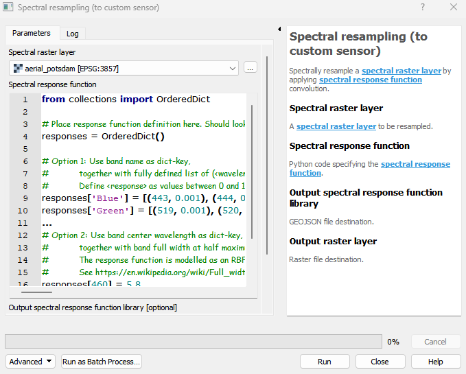
- Spectral raster layer [raster]
A spectral raster layer to be resampled.
- Spectral response function [string]
Python code specifying the spectral response function.
Default:
from collections import OrderedDict

# Place response function definition here. Should look something like this:
responses = OrderedDict()

# Option 1: Use band name as dict-key,
#           together with fully defined list of (<wavelength>, <response>) tuples as dict-value.
#           Define <response> as values between 0 and 1 for each whole nanometer <wavelength>.
responses['Blue'] = [(443, 0.001), (444, 0.002), ..., (509, 1.0), ..., (518, 0.002), (519, 0.001)]
responses['Green'] = [(519, 0.001), (520, 0.002), ..., (550, 1.0), ..., (597, 0.003), (598, 0.001)]
...
# Option 2: Use band center wavelength as dict-key,
#           together with band full width at half maximum (FWHM) as dict-value.
#           The response function is modelled as an RBF around the center wavelength with a width of FWHM / 2.355.
#           See https://en.wikipedia.org/wiki/Full_width_at_half_maximum for details.
responses[460] = 5.8
...
responses[2409] = 9.1
Outputs
- Output spectral response function library [fileDestination]
GEOJSON file destination.
- Output raster layer [rasterDestination]
Raster file destination.
Command-line usage
>qgis_process help enmapbox:SpectralResamplingToCustomSensor:
----------------
Arguments
----------------

raster: Spectral raster layer
    Argument type:  raster
    Acceptable values:
            - Path to a raster layer
response: Spectral response function
    Default value:  from collections import OrderedDict

# Place response function definition here. Should look something like this:
responses = OrderedDict()

# Option 1: Use band name as dict-key,
#           together with fully defined list of (<wavelength>, <response>) tuples as dict-value.
#           Define <response> as values between 0 and 1 for each whole nanometer <wavelength>.
responses['Blue'] = [(443, 0.001), (444, 0.002), ..., (509, 1.0), ..., (518, 0.002), (519, 0.001)]
responses['Green'] = [(519, 0.001), (520, 0.002), ..., (550, 1.0), ..., (597, 0.003), (598, 0.001)]
...
# Option 2: Use band center wavelength as dict-key,
#           together with band full width at half maximum (FWHM) as dict-value.
#           The response function is modelled as an RBF around the center wavelength with a width of FWHM / 2.355.
#           See https://en.wikipedia.org/wiki/Full_width_at_half_maximum for details.
responses[460] = 5.8
...
responses[2409] = 9.1

    Argument type:  string
    Acceptable values:
            - String value
            - field:FIELD_NAME to use a data defined value taken from the FIELD_NAME field
            - expression:SOME EXPRESSION to use a data defined value calculated using a custom QGIS expression
outputResponseFunctionLibrary: Output spectral response function library (optional)
    Argument type:  fileDestination
    Acceptable values:
            - Path for new file
outputResampledRaster: Output raster layer
    Argument type:  rasterDestination
    Acceptable values:
            - Path for new raster layer

----------------
Outputs
----------------

outputResponseFunctionLibrary: <outputFile>
    Output spectral response function library
outputResampledRaster: <outputRaster>
    Output raster layer