Create spectral indices
Create a stack of Awesome Spectral Indices and/or custom indices. Credits: the Awesome Spectral Indices project provides a ready-to-use curated list of Spectral Indices for Remote Sensing applications, maintained by David Montero Loaiza.
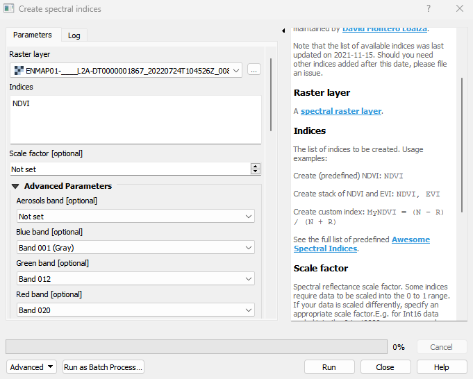
Note that the list of available indices was last updated on 2021-11-15. Should you need other indices added after this date, please file an issue.
Usage:
Open the algorithm from the processing toolbox.
Select a raster layer and define the spectral index to be computed. Optionally, define the bands needed under Advanced Parameters. Then click run.
The output raster can be found under Rasters in the Data Source Panel
Parameters
- Raster layer [raster]
- Indices [string]
The list of indices to be created. Usage examples: Create (predefined) NDVI: <code>NDVI</code> Create stack of NDVI and EVI: <code>NDVI, EVI</code> Create custom index: <code>MyNDVI = (N - R) / (N + R)</code> See the full list of predefined Awesome Spectral Indices. Default: NDVI
- Scale factor [number]
Spectral reflectance scale factor. Some indices require data to be scaled into the 0 to 1 range. If your data is scaled differently, specify an appropriate scale factor.E.g. for Int16 data scaled into the 0 to 10000 range, use a value of 10000.
- Formulas [file]
A JSON file with additional spectral index formulas to be used. See createspectralindicesalgorithm.other.json for the expected format.
Aerosols band [band]
Default: -1
Blue band [band]
Default: -1
Green band [band]
Default: -1
Red band [band]
Default: -1
Red Edge 1 band [band]
Default: -1
Red Edge 2 band [band]
Default: -1
Red Edge 3 band [band]
Default: -1
Red Edge 4 band [band]
Default: -1
NIR band [band]
Default: -1
SWIR 1 band [band]
Default: -1
SWIR 2 band [band]
Default: -1
Thermal 1 band [band]
Default: -1
Thermal 2 band [band]
Default: -1
Canopy background adjustment [number]
Default: 1.0
Gain factor [number]
Default: 2.5
Coefficient 1 for the aerosol resistance term [number]
Default: 6.0
Coefficient 2 for the aerosol resistance term [number]
Default: 7.5
Exponent used for OCVI [number]
Default: 1.16
Exponent used for GDVI [number]
Default: 2.0
Weighting coefficient used for WDRVI [number]
Default: 0.1
Weighting coefficient used for ARVI [number]
Default: 1.0
Soil line slope [number]
Default: 1.0
Soil line intercept [number]
Default: 0.0
Outputs
- Output VRT layer [rasterDestination]
VRT file destination.
Command-line usage
>qgis_process help enmapbox:createspectralindices:
----------------
Arguments
----------------

raster: Raster layer
    Argument type:    raster
    Acceptable values:
        - Path to a raster layer
indices: Indices
    Default value:    NDVI
    Argument type:    string
    Acceptable values:
        - String value
        - field:FIELD_NAME to use a data defined value taken from the FIELD_NAME field
        - expression:SOME EXPRESSION to use a data defined value calculated using a custom QGIS expression
scale: Scale factor (optional)
    Argument type:    number
    Acceptable values:
        - A numeric value
        - field:FIELD_NAME to use a data defined value taken from the FIELD_NAME field
        - expression:SOME EXPRESSION to use a data defined value calculated using a custom QGIS expression
formulas: Formulas (optional)
    Argument type:    file
    Acceptable values:
        - Path to a file
A: Aerosols band (optional)
    Default value:    -1
    Argument type:    band
    Acceptable values:
        - Integer value representing an existing raster band number
B: Blue band (optional)
    Default value:    -1
    Argument type:    band
    Acceptable values:
        - Integer value representing an existing raster band number
G: Green band (optional)
    Default value:    -1
    Argument type:    band
    Acceptable values:
        - Integer value representing an existing raster band number
R: Red band (optional)
    Default value:    -1
    Argument type:    band
    Acceptable values:
        - Integer value representing an existing raster band number
RE1: Red Edge 1 band (optional)
    Default value:    -1
    Argument type:    band
    Acceptable values:
        - Integer value representing an existing raster band number
RE2: Red Edge 2 band (optional)
    Default value:    -1
    Argument type:    band
    Acceptable values:
        - Integer value representing an existing raster band number
RE3: Red Edge 3 band (optional)
    Default value:    -1
    Argument type:    band
    Acceptable values:
        - Integer value representing an existing raster band number
RE4: Red Edge 4 band (optional)
    Default value:    -1
    Argument type:    band
    Acceptable values:
        - Integer value representing an existing raster band number
N: NIR band (optional)
    Default value:    -1
    Argument type:    band
    Acceptable values:
        - Integer value representing an existing raster band number
S1: SWIR 1 band (optional)
    Default value:    -1
    Argument type:    band
    Acceptable values:
        - Integer value representing an existing raster band number
S2: SWIR 2 band (optional)
    Default value:    -1
    Argument type:    band
    Acceptable values:
        - Integer value representing an existing raster band number
T1: Thermal 1 band (optional)
    Default value:    -1
    Argument type:    band
    Acceptable values:
        - Integer value representing an existing raster band number
T2: Thermal 2 band (optional)
    Default value:    -1
    Argument type:    band
    Acceptable values:
        - Integer value representing an existing raster band number
L: Canopy background adjustment (optional)
    Default value:    1
    Argument type:    number
    Acceptable values:
        - A numeric value
        - field:FIELD_NAME to use a data defined value taken from the FIELD_NAME field
        - expression:SOME EXPRESSION to use a data defined value calculated using a custom QGIS expression
g: Gain factor (optional)
    Default value:    2.5
    Argument type:    number
    Acceptable values:
        - A numeric value
        - field:FIELD_NAME to use a data defined value taken from the FIELD_NAME field
        - expression:SOME EXPRESSION to use a data defined value calculated using a custom QGIS expression
C1: Coefficient 1 for the aerosol resistance term (optional)
    Default value:    6
    Argument type:    number
    Acceptable values:
        - A numeric value
        - field:FIELD_NAME to use a data defined value taken from the FIELD_NAME field
        - expression:SOME EXPRESSION to use a data defined value calculated using a custom QGIS expression
C2: Coefficient 2 for the aerosol resistance term (optional)
    Default value:    7.5
    Argument type:    number
    Acceptable values:
        - A numeric value
        - field:FIELD_NAME to use a data defined value taken from the FIELD_NAME field
        - expression:SOME EXPRESSION to use a data defined value calculated using a custom QGIS expression
cexp: Exponent used for OCVI (optional)
    Default value:    1.16
    Argument type:    number
    Acceptable values:
        - A numeric value
        - field:FIELD_NAME to use a data defined value taken from the FIELD_NAME field
        - expression:SOME EXPRESSION to use a data defined value calculated using a custom QGIS expression
nexp: Exponent used for GDVI (optional)
    Default value:    2
    Argument type:    number
    Acceptable values:
        - A numeric value
        - field:FIELD_NAME to use a data defined value taken from the FIELD_NAME field
        - expression:SOME EXPRESSION to use a data defined value calculated using a custom QGIS expression
alpha: Weighting coefficient used for WDRVI (optional)
    Default value:    0.1
    Argument type:    number
    Acceptable values:
        - A numeric value
        - field:FIELD_NAME to use a data defined value taken from the FIELD_NAME field
        - expression:SOME EXPRESSION to use a data defined value calculated using a custom QGIS expression
gamma: Weighting coefficient used for ARVI (optional)
    Default value:    1
    Argument type:    number
    Acceptable values:
        - A numeric value
        - field:FIELD_NAME to use a data defined value taken from the FIELD_NAME field
        - expression:SOME EXPRESSION to use a data defined value calculated using a custom QGIS expression
sla: Soil line slope (optional)
    Default value:    1
    Argument type:    number
    Acceptable values:
        - A numeric value
        - field:FIELD_NAME to use a data defined value taken from the FIELD_NAME field
        - expression:SOME EXPRESSION to use a data defined value calculated using a custom QGIS expression
slb: Soil line intercept (optional)
    Default value:    0
    Argument type:    number
    Acceptable values:
        - A numeric value
        - field:FIELD_NAME to use a data defined value taken from the FIELD_NAME field
        - expression:SOME EXPRESSION to use a data defined value calculated using a custom QGIS expression
outputVrt: Output VRT layer
    Argument type:    rasterDestination
    Acceptable values:
        - Path for new raster layer

----------------
Outputs
----------------

outputVrt: <outputRaster>
    Output VRT layer