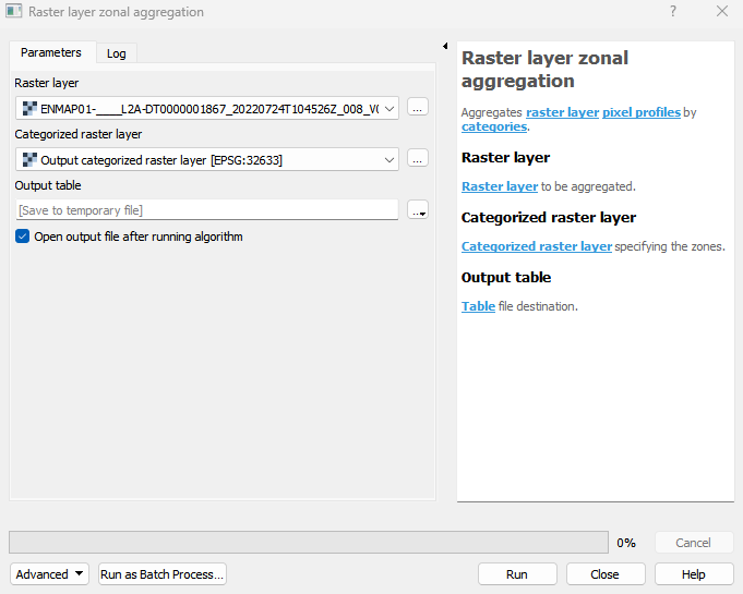
Raster layer zonal aggregation
Aggregates raster layer pixel profiles by categories.
Usage:
Open the algorithm from the processing toolbox.
Select a raster layer and a categorized raster layer defining your zones, then click run.

Parameters
- Raster layer [raster]
Raster layer to be aggregated.
- Categorized raster layer [raster]
Categorized raster layer specifying the zones.
Outputs
- Output table [vectorDestination]
Table file destination.
Command-line usage
>qgis_process help enmapbox:RasterLayerZonalAggregation:
----------------
Arguments
----------------

raster: Raster layer
    Argument type:  raster
    Acceptable values:
            - Path to a raster layer
categorizedRaster: Categorized raster layer
    Argument type:  raster
    Acceptable values:
            - Path to a raster layer
outputTable: Output table
    Argument type:  vectorDestination
    Acceptable values:
            - Path for new vector layer

----------------
Outputs
----------------

outputTable: <outputVector>
    Output table