VRT band math
Create a single-band VRT raster layer specifying a VRT Python Pixel Function. Use any NumPy-based arithmetic, or even arbitrary Python code.
Usage:
Open the algorithm from the processing toolbox.
Select a raster layer and the desired bands. Code your function, then click run.
The output raster can be found under Rasters in the Data Source Panel
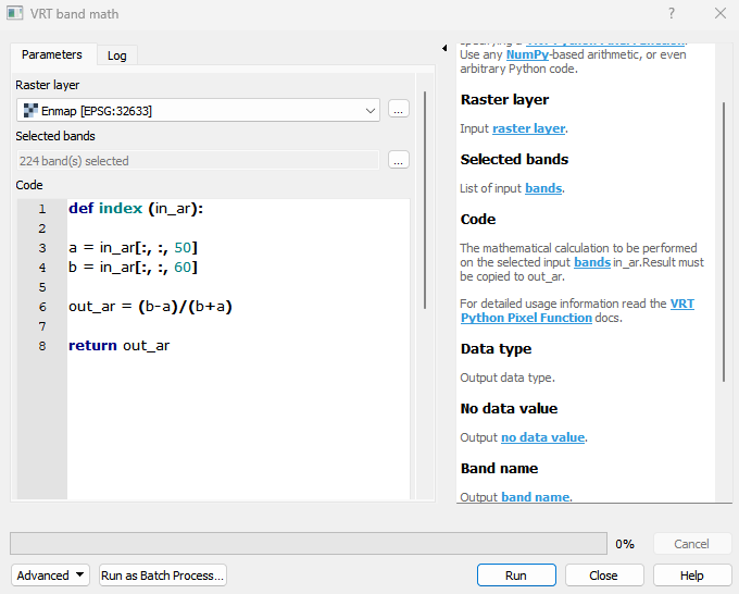
Parameters
- Raster layer [raster]
Input raster layer.
- Selected bands [band]
List of input bands.
- Code [string]
The mathematical calculation to be performed on the selected input bands in_ar.Result must be copied to out_ar. For detailed usage information read the VRT Python Pixel Function docs.
- Data type [enum]
Output data type. Default: 5
- No data value [number]
Output no data value.
- Band name [string]
Output band name.
- Buffer radius [number]
The number of columns and rows to read from the neighbouring blocks. Needs to be specified only when performing spatial operations, to avoid artifacts at block borders.
Outputs
- Output VRT layer [rasterDestination]
VRT file destination.
Command-line usage
>qgis_process help enmapbox:vrtbandmath:
----------------
Arguments
----------------

raster: Raster layer
    Argument type:    raster
    Acceptable values:
        - Path to a raster layer
bandList: Selected bands
    Argument type:    band
    Acceptable values:
        - Integer value representing an existing raster band number
code: Code
    Argument type:    string
    Acceptable values:
        - String value
        - field:FIELD_NAME to use a data defined value taken from the FIELD_NAME field
        - expression:SOME EXPRESSION to use a data defined value calculated using a custom QGIS expression
dataType: Data type (optional)
    Default value:    5
    Argument type:    enum
    Available values:
        - 0: Byte
        - 1: Int16
        - 2: UInt16
        - 3: UInt32
        - 4: Int32
        - 5: Float32
        - 6: Float64
    Acceptable values:
        - Number of selected option, e.g. '1'
        - Comma separated list of options, e.g. '1,3'
noData: No data value (optional)
    Argument type:    number
    Acceptable values:
        - A numeric value
        - field:FIELD_NAME to use a data defined value taken from the FIELD_NAME field
        - expression:SOME EXPRESSION to use a data defined value calculated using a custom QGIS expression
bandName: Band name (optional)
    Argument type:    string
    Acceptable values:
        - String value
        - field:FIELD_NAME to use a data defined value taken from the FIELD_NAME field
        - expression:SOME EXPRESSION to use a data defined value calculated using a custom QGIS expression
overlap: Buffer radius (optional)
    Argument type:    number
    Acceptable values:
        - A numeric value
        - field:FIELD_NAME to use a data defined value taken from the FIELD_NAME field
        - expression:SOME EXPRESSION to use a data defined value calculated using a custom QGIS expression
outputVrt: Output VRT layer
    Argument type:    rasterDestination
    Acceptable values:
        - Path for new raster layer

----------------
Outputs
----------------

outputVrt: <outputRaster>
    Output VRT layer