Spatial Percentile filter
Spatial Percentile filter.
A Spatial Percentile Filter is an image filtering technique that aims to enhance or suppress certain features in an image based on their intensity values. It is a non-linear filter that replaces the value of a pixel with a specified percentile value of its neighborhood.
Usage:
Start the algorithm from the Processing Toolbox panel.
Select the raster to process and modify the parameterization if necessary, then click run.
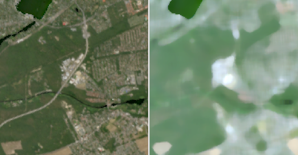
Processed image in comparison to the original.
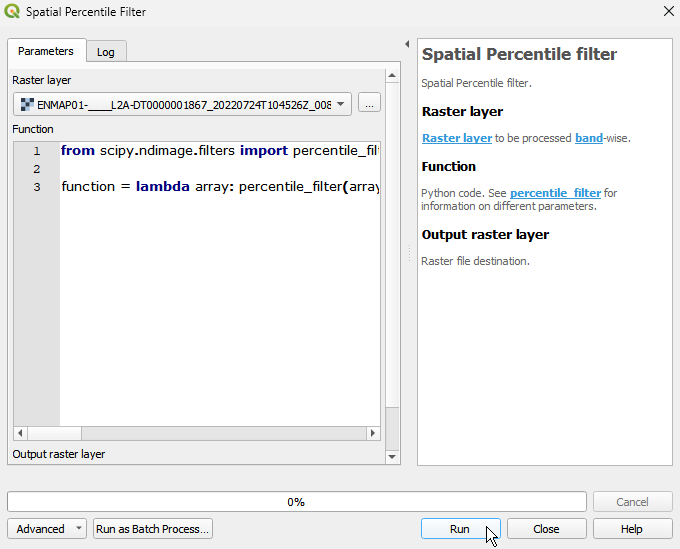
Parameters
- Raster layer [raster]
Raster layer to be processed band-wise.
- Function [string]
Python code. See percentile_filter for information on different parameters.
Default:
from scipy.ndimage.filters import percentile_filter

function = lambda array: percentile_filter(array, percentile=50, size=3)
Outputs
- Output raster layer [rasterDestination]
Raster file destination.
Command-line usage
>qgis_process help enmapbox:SpatialPercentileFilter:
----------------
Arguments
----------------

raster: Raster layer
    Argument type:  raster
    Acceptable values:
            - Path to a raster layer
function: Function
    Default value:  from scipy.ndimage.filters import percentile_filter

function = lambda array: percentile_filter(array, percentile=50, size=3)
    Argument type:  string
    Acceptable values:
            - String value
            - field:FIELD_NAME to use a data defined value taken from the FIELD_NAME field
            - expression:SOME EXPRESSION to use a data defined value calculated using a custom QGIS expression
outputRaster: Output raster layer
    Argument type:  rasterDestination
    Acceptable values:
            - Path for new raster layer

----------------
Outputs
----------------

outputRaster: <outputRaster>
    Output raster layer